Article of the
Month - March 2022
|
Data Privacy Protection and Geographic Data Use
as an Answer to Covid-19
Rosario CASANOVA, Carlos Andres CHIALE and Mathilde SARAVIA, Uruguay
 |
 |
|
| Rosario Casanova |
Carlos Andrés
Chiale |
Mathilde Saravia |
This article in .pdf-format (27 pages)
This
article aims to reflect on the relevance of geographic data use
in the COVID-19 pandemic and its relationshop with the privacy rights of
the people involved.
SUMMARY
Based on the importance of the concept of proximity or direct contact
associated with the spread of the COVID-19 virus, this article aims to
reflect on the relevance of geographic data use in this pandemic and its
relationship with the privacy rights of the people involved. Thus, this
article includes a study of the international and Uruguayan regulations
related to geographical and, in particular, localization data.
Finally, specific considerations about proximity contact applications as
a tool for combating COVID-19 are presented, making special emphasis on
the Uruguayan case.
1. INTRODUCTION
The spread of the COVID-19 or SARS-CoV-2 virus and the consequent
declaration of a pandemic, issued by the World Health Organization in
March 2020, are now a problem that exceeds the sanitary issue. It brings
deep repercussions at an economic, social, political, cultural and
environmental level with impacts on the local, regional and global
scale. Consequently, the measures or responses implemented by different
countries involve different dimensions that affect the lives of their
inhabitants.
According to recent scientific research, established transmission
pathways of SARS-CoV-2 are said to be both, close contact with patients
with COVID-19 and the absorption of droplets through the airways (Tan
and Wang, 2020).
Therefore, the location of a virus carrier is particularly relevant as
its proximity to other people is the main factor of infection (Yi,
Lagniton, Ye, Li, and Xu, 2020). Thus, geographic data and geomatics
tools (GeoSciencie) take a prominent role in addressing this pandemic.
One of the GIS main strengths is the ability to integrate diverse
georeferenced data sets, this facilitates the aggregation of health data
with contextual characteristics. There are several academic studies of
descriptive models that leverage this capability to examine the
geographical associations of COVID-19 with the socio-economic and
environmental characteristics of the region.
Based on the importance of the concept of proximity or direct contact
associated with the spread of the virus, this article proposes a
reflection on the role of geographical information as a tool for
combating COVID-19 and its relationship with individual and collective
law.
2. USE OF GEOGRAPHIC INFORMATION
Incorporating geographic information science and technology into
surveillance, modeling, and response to the COVID-19 pandemic, improves
not only the understanding but also the control of the disease.
This pandemic has highlighted the usefulness of applying geosciences to
visualize cases and identify the most vulnerable areas, as well as the
use of location-based intelligence tools to improve data representation
deficiencies. (Rosenkrantza, Schuurmana, Bellb, & Amramc, 2020).
Therefore, in this article two different uses of geographic data are
presented, one related to mobile applications and the other to the use
of the geographical information as response in the fight against this
pandemic.
2.1 Using Location in Apps
Nowadays, there is a wide number of mobile applications that require
the geolocation of the devices as an input to carry out their function.
This is the case of those which allow home delivery (PedidosYa[1],
Rappi[2]), request transfer in vehicles (Uber[3])
and even messaging applications in which the location can be sent in
real time to other contacts (WhatsApp[4]). All
applications that require this type of geolocation ask the user for
permission to gather this data.
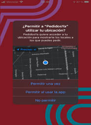
Fig. 1: Screenshot on a mobile device from the
PedidosYa app when location use is requested. Source: Own elaboration.
The use of localization by applications can be diverse. There are
many applications in which the user's location data is key for them to
operate. On the other hand, there are other applications in which the
user's location is not essential but still requested. In those cases,
location data is used to promote commercial stores when proximity is
detected. In all cases, the use given to this information by application
providers is uncertain.
In this sense, a case that has gained a lot of popularity in Spain
refers to LaLiga mobile application. This Spanish football application
provides information about football competitions, fixtures, teams, and
players as well as national and international results.
When using this app, access to the location and microphone of the user's
mobile device is requested. With these permissions, the place where the
user was watching the game could be clearly identified because the
device's microphone and geolocation were activated. With microphone
access granted, anytime the user was near a television broadcasting a
football game was detected, registering its location. Having gathered
this information, it was possible to localize bars and restaurants which
broadcasted football matches without paying royalties.
Consequently, the Spanish Data Protection Agency fined LaLiga with
250.000 euros (July 2019) for the intrusion of at least 50.000
Spaniards' mobile phones, due to a violation of the principle of
transparency in not reporting microphone access in the application.
This event highlights the risks brought by the misuse of the data
accessed by some apps. Although prior consent to have access to location
data is requested, users do not always become fully aware of the
implications and consequences of this authorization. Thus, it is
important to stand out the relevance of including the ethical use of
geographic information on the collective agenda.
2.1 The geoinformation use in the fight against the pandemic
2.2.1 Exposure Notification
With the global health emergency as a framework and considering the
fact that epidemiological monitoring is thought as a key to contain the
pandemic, two leading companies in terms of technology in mobile
devices, Apple and Google, joined forces to develop a system that
facilitates the crisis monitoring, by sending alerts of proximity to
infected users. This system, called exposure notification, is based on
the premise of taking care of the security and privacy of users. The app
strictly focuses on carrying out the required epidemiological monitoring
and does not directly use the user's location data.
Exposure notifications can then be enabled in different apps on both iOS
or Android mobile operating systems. These apps require a strict
authorization from Apple and Google in order to provide the user with
exposure notifications. Authorization which is only given to official
institutions in each country, in the case of Uruguay, the app is called
Coronavirus Uy[5].
Exposure notifications do not use location data, they work using
bluetooth to share codes with other devices that are nearby and have
downloaded and activated this app. Each mobile device constantly
broadcasts a random number and simultaneously records those codes coming
from nearby devices. (Betarte, et al, 2020). These indicators are stored
in each device for 14 days. In the event that a user tests positive for
COVID-19, he can inform the application, which will request permission
to upload the numbers generated by its device to a central server. Every
day, the indicators received by each mobile are compared with those
uploaded to the central server and in case of a match, an exposure alert
notification will be given. From this alert, each person can use the
application to request more information or assistance but can also
choose not to tell anyone that they received the alert.
From our point of view, exposure alert applications are an efficient and
decentralized mechanism for people to collaborate and receive virus
exposure alerts quickly, while at the same time, respecting the privacy
and willingness of all involved. In the case of Uruguay, the Coronavirus
UY application also allows citizens with possible symptoms of the
SARS-CoV-2 virus to be connected to health care providers, in order to
reduce waiting times for medical attention. Despite the possible
efficiency of this application, its success depends exclusively on the
population's active use (Cascón, 2020).
Although in the next section we will go into the legal aspects, it is
important to clarify that all the information collected in the
application is covered by the Law on Protection of Personal Data and by
the privacy policy of the application itself (Figure 2).
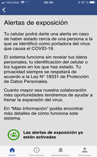
Fig. 2: Screenshot of the notification about the
exposure alert in the Coronavirus Uy application. Source: Own
elaboration.
2.2.2 COVID-19 situation mapping
The global understanding of this
pandemic´s impact has proportionally grown with the use of mapping apps
in public and private sectors. The most popular uses of mapping tools
are the daily publications of news agencies or online dashboards in near
real time (Boulos and Geraghty, 2020). Although many dashboards have
been made, the most widespread example has been developed by the Johns
Hopkins University[6]. These maps provide a clear
visual representation of the impact of COVID-19 on morbidity and
mortality and represent an effective political and social tool to
communicate the impact of the disease (Rosenkrantza, et al, 2020).
3. LEGAL ASPECTS
There is no doubt that the SARS-CoV-2 virus has unleashed a world
full of uncertainties, not only about its origins, forms of propagation,
treatment, or possible vaccine, but also about the use of individual
data as a tool to combat the pandemic. The privacy of data, the ethics
in the use of information, particularly geographic information at the
service of decision makers, raise many concerns and questions that are
not easily answered (Pérez-Colomé, 2020).
This emergency situation should not imply a suspension of the
fundamental right to personal data protection. Nor could the data
protection regulations be used to hinder or limit the effectiveness of
the measures adopted by the health authorities. It is possible to think
that a dichotomy is being created between individual freedom and
community well-being. This discussion is not new but, at this time, is
becoming more visible because of globalization, the wide access to
international news, the Internet, the rapid spread of the SARS-CoV-2
virus, the widespread ignorance and uncertainty about the pandemic
itself.
Therefore, this article includes aspects related to the international
and Uruguayan legal framework regarding the privacy of personal data,
focusing on the analysis of the protection of location data and the use
of geographic information as a tool to combat the pandemic in the
country.
3.1 Personal and sensitive data international legal framework
The protection of personal data has been the object of regulation of
several international treaties to which our country has adhered.
However, the approach of such international standards precedes the
"Internet" phenomenon, and consequently, although they are an
unavoidable antecedent, they do not provide sufficient legal support to
modern data traffic in the ICT era. On the other hand, there is no
international body that "manages" data privacy on a global scale (Elgar,
2011). Consequently, in order to analyze international law on personal
data protection, we must resort to comparative law at a regional level
(the case of the European Union) and at the national level of some
countries, such as the United States and China.
The protection of personal data in the European Union is presented as
the paradigm in the matter and has been a reference for our country. In
this sense, it is positioned in the human right to data protection in
the digital era by enshrining in the Charter of Fundamental Rights[7]
itself that everyone has the right to the protection of personal data
concerning him or her, fair processing, for specific purposes and based
on the consent of the person concerned and enshrines the right of
everyone to access the data collected concerning him or her and to
rectify it.
Unlike the European system, the United States data protection is
regulated on a sectoral basis: it focuses on consumer protection from an
economic perspective and not as a personal right. In North American law,
data protection is part of the consumer protection law and the
supervision of its compliance is a Federal Trade Commission´
responsibility. The Patriot Act of the United States was enacted after
the terrorist attacks on September 11, 2001 and enabled security
authorities to have access -in suspicious cases-, to local servers’ data
stored without a court order. Internet and cloud providers could also be
forced to disclose personal data even without informing those affected.
In 2015, the United States Freedom Act was enacted again restricting the
powers of the investigating authorities.
However, the Cambridge Analytica scandal in 2016[8]
prompted the state of California to draft a strict law to protect user
data, liable since January 2020. The California Consumer Privacy Act
aims to allow consumers to be aware of which companies collect and use
their data, as well as to demand, if necessary, to be deleted. In any
case, nowadays there is no national law protecting the entire country,
but some steps have been taken towards European standards of regulation
on data general protection (GDPR-General Data Protection Regulation)
(Thielemann, 2020).
Moreover, another great power such as China does not have, to date, a
general data protection law. In 2017, the personal data regulation was
given through a Cybersecurity Law that aimed at the network security and
strengthening of data protection. The China Cyberspace Administration
(CAC), the highest internet administrative law, enacted in June 2019 the
Data Protection Regulatory Directive that sets the standards for
customer data collection and processing, thus it represents future
orientation basis to law. (Thielemann, 2020)
From the above, it can be concluded that although data privacy issues
have been placed on the public agenda, several countries -at a national
level as well as the world in its global concept- do not have specific
regulations which include all aspects of privacy and data security
intimes of pandemic (Cascón, 2020). The following section addresses the
study of the Uruguayan case and the relationship between the regulation
in force and the geographic and health data use.
3.2 The protection of personal data in Uruguay
Uruguay's commitment to personal data protection arises from the
ratification of different international instruments that address this
issue. Since 1948 Uruguay has ratified the Universal Declaration of
Human Rights, the International Covenant on Civil and Political Rights
(1966), and at a regional scale, the American Convention of Human Rights
Pact of San José, Costa Rica.
The Uruguayan personal data protection main rule is the Personal Data
Protection Law (Law No 18,331)[9] which establishes
the right to personal data protection as “inherent to the human person”
and refers to the Constitution of the Republic.
According to the referred law, personal data is defined as "information
of any kind referring to specific or determinable natural or legal
persons"; this is "... any numerical, alphabetic, graphic, photographic,
acoustic or any other information that refers to them."[10]
In short, personal data is “... any type of information that can
directly identify us or makes us identifiable, as our name, address,
telephone, identity card, RUT, fingerprint, member number, student
number, a photograph or even DNA "
However, as sensitive data the law considers: "personal data that reveal
racial and ethnic origin, political preferences, religious or moral
convictions, union affiliation and information regarding health or
sexual life."
In this sense, it is important to specify that as one of the forms of
protection the law requires to publicize personal data, the express
consent of the person involved must be given and in the case of
sensitive data, an express and written consent is required. (Betarte et.
Al, 2019).
Likewise, categories of specially protected data are regulated, such as
health and telecommunications data, among others. Regarding health data,
the law empowers public or private health institutions and health
sciences professionals to “… collect and process personal data related
to the physical or mental health of patients who have been under
treatment…” provided that professional secrecy principles are complied
with, and that the law itself establishes the need for express consent.
Within this framework, and in accordance with transcribed legal
definitions, location data fits into the personal data category, while
the data on the health status of a person, such as being infected by
COVID-19 must also be considered as sensitive and specially protected
data.
It is clear from the above that location and individual health data are
protected by international and national regulations but can be limited
when the community health good takes precedence, only with regard to the
requirement of prior consent. Limitations that always protect the
anonymity of the person so that the security and confidentiality in the
treatment of the data is preserved.
Therefore, it can be assured that Uruguayan legal requirements, in terms
of personal data protection, are at the level of the highest
international standards, which is materialized in the imposition of
legal obligations to be contemplated in the technical requirements.
4. CONCLUSIONS
Even though there are many uncertainties surrounding the pandemic, it
is unquestionable that proximity between people is the main factor of
contagion, thus the location of an infected person becomes particularly
relevant for himself and for others. The spread of infectious diseases
is mainly a spatial process; therefore, geospatial data, technologies
and analytical methods play a key role in understanding and responding
to the COVID-19 disease pandemic.
The opportunities to incorporate geomatic tools into monitoring,
modeling and response to this pandemic, range from developing spatial
data infrastructures for surveillance, incorporating mobility data into
infectious disease forecasting, using geospatial technologies for
digital contact tracing, integrating geographic data into COVID-19
modeling, investigating geographical health disparities and social
vulnerabilities, and reporting disease status or infrastructure status
in order to return to normal operations.
Additionally, in recent times, the pandemic daily monitoring has been
done through the use of geographic data in dashboards. In this sense
Uruguay is not unaware of global activity by implementing its own
visualizer (MIRA), in which the number of contagions is daily shown, but
with a level of data disaggregation due to protect privacy data of the
people involved.
Regarding normative aspects, for the Uruguayan legal system, the
location data falls into the category of personal data whose protection,
following the European model, has a fundamental human right status. The
location of a person carrying the SARS-CoV-2.2 virus also falls into the
specially protected personal data category according to the national law
personal data definition. Thus, it is necessary a dual requirement for
its diffusion, which is an express and written consent. For this reason,
Uruguay has national regulations that strongly protect and ensure the
protection of individual and health data.
The geographic data used as a spatial analysis tool to support public
decision-making in the fight against the pandemic are also protected in
Uruguay, since the anonymity of those affected is preserved. While this
is a strength, it can also be a weakness since it limits the generation
of academic specific research. This impact can be minimized by providing
these data with a higher level of disaggregation, as the one used for
the national population and housing censuses (in which the anonymity of
the data is also protected).
According to this research and regarding other location data apps, we
can state that the registration of contacts via bluetooth used in the
proximity alert applications, is the most advanced technique and also
the one that works best for tracking those who are infected. This tool
is not only recommended in terms of its positional quality, but also and
mainly, because it is more efficient in protecting individual privacy.
In particular, the Coronavirus Uy application plays a fundamental role
since it provides the above-mentioned benefits and, at the touch of a
button, professional healthcare assistance to the community in general
and to those infected in particular. Additionally, it is a tool that
solves, or at least gives a very big and invisible hand, to the weakest
link in the fight against COVID-19, which is the "epidemiological
monitoring".
From a legal point of view, the application complies with the
requirements of express and written authorization, requested in national
regulations. Since it requires the user´s consent: specifically, the
willingness and action to communicate that they contracted the virus and
the acceptance of generating an alert for exposure to the users of the
application who were close.
In other words, from our point of view, proximity alert tools are very
suitable and comply with people's privacy rules. Therefore, it is a
recommended tool to be used in several countries, even if they do not
have a specific national regulation that protects the privacy of
personal data.
It is fair to say that while the tool has these strengths, it has a
great weakness that refers to the need for massive use by all residents.
A fact that can be a problem because it requires mobile phones that
support this technology and users who know how to use them properly.
In any case, these limitations can be overcome, but a strong public
policy is required to promote, train, facilitate and ensure that a very
high percentage of the inhabitants use it. To this end, strong
communication campaigns, training plans, problem-solving centers for
users, and even the possibility of designing and constructing simple
special devices, free of charge for the inhabitants, created solely to
fulfill the functions of data exchange and proximity alerts, could be
considered. The academy has a lot to contribute in this sense.
[1] Web site of Pedidos Ya:
https://www.pedidosya.com.uy/
[2] Web site of Rappi:
https://www.rappi.com.uy/
[3] Web site of Uber:
https://www.uber.com/
[4] Web site of Whatsapp:
https://www.whatsapp.com/
[5] Web site of Coronavirus Uy:
https://www.gub.uy/ministerio-salud-publica/politicas-y-gestion/informacion-sobre-aplicacion-coronavirus
[6]
Web site of the Dashboard of John Hopkins University:
https://coronavirus.jhu.edu/map.html
[7] The Charter of Fundamental Rights is a
document including a set of personal, civil, political, economic and
social rights of citizens and residents of the European Union,
proclaimed by the European Parliament, the Council of the European Union
and the European Commission in December 2000. https://www.europarl.europa.eu/charter/pdf/text_es.pdf
[8] Cambridge Analytica is a data analysis
company that accessed data from 87 million Facebook users.
[9] Law of Personal Data, Law 18331 of August
11, 2008:
https://www.impo.com.uy/bases/leyes/18331-2008
[10] Regulatory Decree (of the Law) No. 414/009
of August 31, 2009:
https://www.impo.com.uy/bases/decretos/414-2009/40
REFERENCES
Adekunle, I. A., Onanuga, A., Wahab, O., Akinola, O. O. (2020).
Modelling spatial variations of coronavirus disease (COVID-19) in
Africa. Science of The Total Environment, 138998.
Betarte, G., Campo, J. D., Delgado, A., Ezzatti, P., Forteza, Á.,
González, L., Martin, M. Muracciole, B. y Ruggia, R. (2020) Desafíos de
seguridad y privacidad en el diseño e implementación de soluciones de
rastreo de proximidad. Retrieved from:
http://www.pedeciba.edu.uy/docspd/covid_CT_position_betarteetal-1.pdf
Boulos, M. N. K., Geraghty, E. M. (2020). Geographical tracking and
mapping of coronavirus disease COVID-19/severe acute respiratory
syndrome coronavirus 2 (SARS-CoV-2) epidemic and associated events
around the world: how 21st century GIS technologies are supporting the
global fight against outbreaks and epidemics.
Brito, M. (1985). “El principio de legalidad e interés público en el
derecho positivo uruguayo”, La Justicia Uruguaya.
Cascón-Katchadourian, J. (2020). “Tecnologías para luchar contra la
pandemia Covid-19: geolocalización, rastreo, big data, SIG, inteligencia
artificial y privacidad”. Profesional de la información, v. 29, n. 4,
e290429. Retrieved from:
https://doi.org/10.3145/epi.2020.jul.29
Economic Commission for Latin America and the Caribbean (UN-ECLAC) and
United Nations Committee on Global Geospatial Information Management for
the Americas (UN-GGIM: Americas) (2020) Questionnaire on geospatial
response to COVID-19 in the Americas.
Edward (2011). Research Handbook on Governance of the internet, Edition
I.
Kuhn, C., Beck, M., Strufe, T. (2020). Covid Notions: Towards Formal
Definitions--and Documented Understanding--of Privacy Goals and Claimed
Protection in Proximity-Tracing Services. arXiv preprint
arXiv:2004.07723.
Pérez-Colomé, J. (2020). “Apple y Google se alían para facilitar que las
apps para rastrear el coronavirus estén en todos los móviles”. El país,
April 10, 2020. Retrieved from:
https://elpais.com/tecnologia/2020-04-10/apple-y-google-se-alian-para-crear-un-sistema-de-rastreo-del-coronavirusque-no-necesite-descargar-una-app.html
Rosenkrantz, L., Schuurman, N., Bell, N. & Amram, O. (2020). The need
for GI Science in mapping COVID-19. Health & Place, 102389.
Santirso, J. (2020). “Corea del Sur: contra el coronavirus, tecnología”.
El país, March 14, 2020. Retrieved from: https://elpais.com/tecnologia/2020-03-13/corea-del-sur-contra-el-coronavirus-tecnologia.html
Schwartz, P. M., Peifer, K. N. (2017). Transatlantic Data Privacy Law.
Geo. LJ, 106, 115.
Smith, C., Mennis, J. (2020). Peer Reviewed: Incorporating Geographic
Information Science and Technology in Response to the COVID-19
Pandemic. Preventing Chronic Disease, 17.
Orellano, D., Toledano, B. (11 de junio de 2019). Multa a LaLiga de
fútbol por usar el móvil de 50.000 españoles para espiar. El Mundo.
Retrieved from:
https://www.elmundo.es/tecnologia/2019/06/11/5cff9a0ffdddff531a8b466e.html
Tang, L. Y., Wang, J. (2020). Anesthesia and COVID-19: What We Should
Know and What We Should Do. Seminars in Cardiothoracic and Vascular
Anesthesia, 24(2), 127–137. Retrieved from:
https://doi.org/10.1177/1089253220921590
Thielemann, S. (Novembre 27, 2020). Protección de datos fuera de la UE.
HornetSecurity. Retrieved from:
https://www.hornetsecurity.com/es/seguridad-de-la-informacion/proteccion-de-datos-fuera-de-la-ue/
Yi, Y., Lagniton, P. N., Ye, S., Li, E., & Xu, R. H. (2020). COVID-19:
what has been learned and to be learned about the novel coronavirus
disease. International journal of biological sciences, 16(10), 1753.
BIOGRAPHICAL NOTES
Rosario Casanova (Uruguay) is a Land Surveyor
Engineering, expert in geomatics, geo-technologies, urban planning, she
has a master's degree and a doctorate in these areas.
Since 1994 she is a professor at the Institute of Land Surveying of the
Faculty of Engineering of the University of the Republic, Uruguay. Being
the Director of the Institute of Surveying from 2014 to March of this
year.
She is the chair of the United Nations Academic Network for the Americas
for Geospatial Data Management (UN-GGIM) since it was created in 2017.
She has served as professor in the Lincoln Institute of Land Policy
(LILP) in the Latin America and Caribbean Program and carried out
several research projects on the informal land market.
She has presented research in regional and international events.
Carlos Chiale (Uruguay) has graduated as Cartography
Technologist (2015) in the University of the Republic, Uruguay, and as
Bachelor degree of Sytems (2020) in ORT University.
He works as consultant in information in National Emergency System of
Uruguay.
He is a member of Geomatic Department at Surveying
Institute, Engineering Faculty of the University of the Republic,
Uruguay.
Matilde Saravia (Uruguay) has graduated as a lawyer
(2006) and as planning and urban development magister (2017) in the
University of the Republic. She has specialized herself in planning,
integrated water management and environment since 2009 and she works as
a consultant in these areas. She is a member of the Technical Legal
Department of the Land Surveyor Institute, Engineering Faculty,
University of the Republic.
CONTACTS
Rosario Casanova
Instituto de Agrimensura, Facultad de Ingeniería, Universidad de la
República.Montevideo
URUGUAY
Carlos Andrés Chiale
Instituto de Agrimensura, Facultad de Ingeniería, Universidad de la
República.
Montevideo
URUGUAY
Matilde Saravia
Instituto de Agrimensura, Facultad de Ingeniería, Universidad de la
República.
Montevideo
URUGUAY
Email: matildes@fing.edu.uy


