Article of the
Month - July 2021
|
FIG e-Working Week 2021 Keynote:
The Challenges
for Smart Surveyors in a New Reality
Jack Dangermond and FIG President Rudolf Staiger
Instead of a paper we would like to share with you a series of video
recordings from the keynote sessions of FIG e-Working Week 2021.
In this video that is offered to you in this "Article of the
Month of July 2021" the founder and President of Esri - Environmental Systems Research
Institute, Jack Dangermond talks with FIG President
Rudolf
Staiger, about the impactful latest trends in GIS software
technology, how they impact surveying and the FIG community as well as
thoughts and considerations on the future of the profession.
The interview took place on Monday 21 June 2021 and duration of the
video is 1½ hours.
Watch and be inspired by the keynote session here:
https://youtu.be/ccSnpWM-G9M
About the keynote speakers
 |
Jack Dangermond, Founder
and President Esri - Environmental Systems Research Institute
A landscape architect by training, Jack Dangermond founded Environmental Systems Research Institute (Esri) in 1969 with a vision that computer mapping and analysis could help us design a better future. Under Dangermond's leadership, that vision has continued to guide Esri in creating cutting-edge GIS and Geodesign technologies used in every industry to make a difference worldwide.
Dangermond fostered the growth of Esri from a small research group to an organization recognized as the world leader in GIS software development.
Esri employs more than 4,000 people worldwide. Many who shared his passion for GIS in the early days are still with the company and remain dedicated to helping the users to be successful.
|
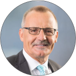 |
Rudolf Staiger, FIG
President, Professor at the University of Applied Sciences
Bochum, Dept. of Surveying Engineering and Geoinformatics
Prof. Dr.-Ing. Rudolf Staiger is teaching Surveying
Engineering at the University of Applied Sciences in Bochum
(Germany). His areas of special interest are instrumentation and
calibration of geodetic sensors, Laser scanning and data
analysis. He studied Geodesy in Karlsruhe (Germany, University
of Karlsruhe) and in Paris (France, ENSG). The subject of his
doctoral thesis is “close range triangulation with theodolites
for coordinate measuring purposes”.
Rudolf spent 6 years in industry with KERN and
Leica-Geosystems (both in Switzerland) as Systems Engineer,
Product Manager and Software Developer. From 1994 to 2005 he was
teaching Surveying Engineering at the University of Essen
(Germany). Since then he teaches in Bochum where he also served
as Vice-President of the University for Research & Transfer
(2009-2016). Rudolf is very active in FIG. He was the Chair of
Commission 5 (Positioning and Measurement) and is currently
acting as Vice-President. His language abilities are German,
French and English.
|


