FIG Congress 2022 Keynote:
Geospatial Excellence for a Better Living - Digitalisation and Modern
Surveying and Cadastre in a Post-Covid19 Era
Ewa SURMA, Rumyana TONCHOVSKA and Paweł HANUS
Instead of a paper we would like to share with you a series of video
recordings from the keynote sessions of FIG Congress 2022 in the coming
months.
In this recording that is offered to you in this "Video of the Month
Series" Ewa Surma, Rumyana Tonchovska and Paweł Hanus take the
audience through their undertakings and experiences during these
past years with the Covid19 pandemic, how the transformation has
been handled, and what learnings can be drawn from this.
The keynote set the scene of the Congress. Even though at
the onset of the pandemic, many surveying, geodetic and land
administration organizations were already quite far in the
digitalisation of data and processes, the last two years was
speeding up this transformation.
Ewa Surma: UThe Activities f GUGIK During the Pandemic
During the pandemic Head Office of Geodesy and Cartography
(GUGiK) was very active on working on opening the data from
the Central Geodetic and Cartographic Resource and also on
digitization geodesy and easy access to data. All users can
download open data without any limitations. All works
concentrated on legislation and amendment of Geodetic and
Cartographic Law and connected 14 regulations. The amendment
of the Geodetic and Cartographic Law this is also 14
regulations that were issued within one year. Hear more
about how GUGiK has worked on the digitalization process,
changes made during these past two years and their
experience today.
Rumyana Tonchovska: Digital Transformation and the role of
Land Administrations - FAO, FIG and UNECE/WPLA joint
publications
Starting from the digital disruptions triggered by the
Covid19 pandemic, the e-book on Digital
Transformation and the future role of Land Administration examines
the state-of-play and future directions for digital
transformation in land administration in the UN-ECE region
and beyond. Complementary to the e-book, a Knowledge for
Investment Brief: Sustainable Digital Transformation
of Land Administration has been prepared, which
provide a guidance to the land administration authorities
and decision makers on how to develop their action plans and
investment plans for their journey toward digital
transformation. The publications are jointly prepared by the
FAO, FIG and the UNECE/WPLA and went through a series of
consultations.
Looking ahead, land administration organizations can build
from the momentum of the recent Covid19 pandemic success
stories. They must re-evaluate current action and investment
plans for digital transformation and further opportunities
for acceleration.
Paweł Hanus: Better living after Covid – the surveyor point
of view
The time of the Covid pandemic was a time of challenge and
change for all of us, including surveyors. And while the
changes in surveying in Poland were not entirely related to
the pandemic, the pandemic certainly sped up to them. From
the point of view of the contractor of geodetic works, the
most important changes during this period include the
introduction of digital technical documentation of geodetic
works, the acceleration of the change in the method of
servicing surveyors to the Internet service, and the
transfer of geodetic documentation from the analogue to
digital form. These actions resulted in significant, mostly
positive, changes in carrying out geodetic work. This
presentation provides some details of these changes.
Watch and be inspired by the keynote session here:
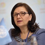
About the keynote speakers
Ms. Ewa Surma - Director in Head
Office of Geodesy and Cartography (GUGIK), Poland
Ewa Surma is Master of Science, AGH University of Science and
Technology, postgraduate studies GIS: Jagiellonian University in
Cracow, University of Salzburg. Working experience with INSPIRE
implementing rules (metadata, interoperability of spatial data sets
and services, data and service sharing). Expert experience of
Geospatial data management and analysis. Experience of working
internationally. Involved with projects throughout the State of
Massachusetts and boundary research, planning and zoning information
for projects in many town and counties. At present works as a
Director of the Strategy, International Cooperation and Public
Information department of Head Office of Geodesy and Cartography.
LinkedIn:
www.linkedin.com/in/ewa-surma-b1b603102
Ms. Rumyana Tonchovska- Senior Land Administration Officer, FAO
of the UN
Rumyana Tonchovska is a Senior Land Administration-Information
Technology Officer of the Food and Agriculture Organization of the
UN (FAO), based in Rome. She has practical experience in 26
countries across Eastern Europe, Asia and Africa in design,
development and implementation of large scale, complex information
systems for land tenure, indirect taxation and building Spatial Data
Infrastructure. Rumyana is leading various innovations to support
countries to make better use of the available data and technologies.
Prof. Paweł Hanus- AGH
University of Science and Technology, Poland
Paweł Hanus prof. AGH - a specialist in cadastre, real estate
management and spatial planning; academic professor in the
Department of Integrated Geodesy and Cartography at the AGH
University of Science and Technology; member of the Geodesy
Committee of the Polish Academy of Sciences, the National Geodetic
and Cartographic Council and the Association of Polish Geodesists;
National Delegate of Commission 8 of the FIG - Spatial Planning and
Development; author and co-author of over 100 articles and
monographs, both professional and scientific; academic teacher and
former vice-Dean of the Faculty of Mining Geodesy and Environmental
Engineering at the AGH University of Science and Technology.